We are back with the fifth edition of the Student Challenge design competition for students. Are you ready? Discover the challenge and how you can win the competition here.

Calibration Lys Reach 140 (Sint-Baafs-Vijve to Deinze)

  • Location: SINT-BAAFS-VIJVE [BE]
  • Discipline: URBANISME & ONTWERP, WATERBOUW
  • Period: 2020 - ...
  • BCA 2024 - Silver: Urban Development, Infrastructure & Mobility Award 2024
    December 2024
  • Publication of specifications of zone A2 ‘the remaining part of the downstream section of Reach 140’
    Mid-2021
  • Start of works at zone A1
    Mid-2021
  • Submission of environmental permit for the downstream half of Reach 140
    March 2021
  • Publication of specifications for zone A1 ‘banks’
    October 2020
  • Start of study phase
    February 2020
  • Seine-Schelde_Leie Pand 140 Sint-Baafs-Vijve Deinze De Vlaamse Waterweg Seinebekken SBE engineering #teamsbe #expertsatplay
    Copyright: De Vlaamse Waterweg
  • Seine-Schelde_Leie Pand 140 Sint-Baafs-Vijve Deinze De Vlaamse Waterweg Seinebekken SBE engineering #teamsbe #expertsatplay
    Copyright: De Vlaamse Waterweg

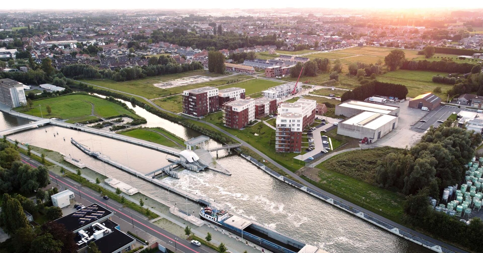
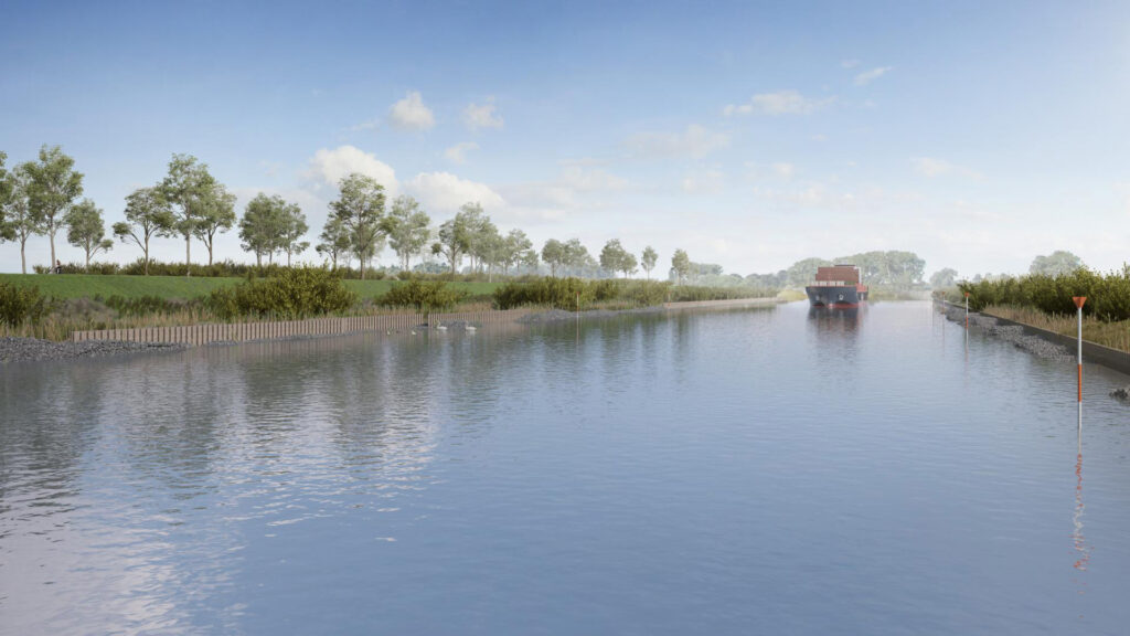
The calibration (widening and deepening) of the Lys forms part of the broader Seine-Scheldt project. This includes the implementation of an inland navigation link for larger vessels (CEMT class Vb) between the Seine basin in the south (Paris, Rouen, Le Havre) and the Scheldt basin and the North Sea ports in the north (Antwerp, Ghent, Zeebrugge, Amsterdam, Rotterdam). The Lys axis as an inland waterway between Ghent and the French border has a total length of 71km and is divided into 7 sections or reaches (from downstream to upstream). The study area for the present project covers ‘Reach 140’ along the Lys, between the Sint-Baafs-Vijve lock (upstream) and the Noorderwal winding hole at Deinze (downstream). SBE is responsible for the entire study and the monitoring of the works.

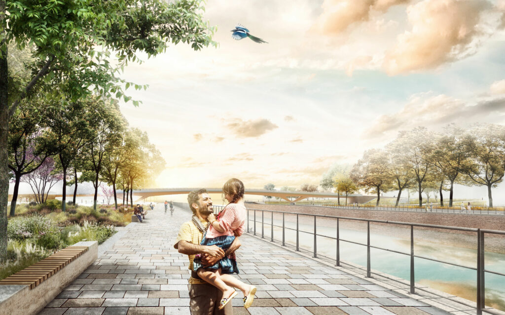
In addition to the widening and deepening of the Lys, the banks will also be fitted out to optimize water management, nature, recreation, heritage, and landscape. Therefore, the necessary works for economic progress will be seized upon to give the banks the best possible configuration. This means that good ecological potential is achieved and that space for water is created again. In the project, a balance must always be found between the various disciplines: the nautical aspect, the landscape, the ecological and recreational aspects.

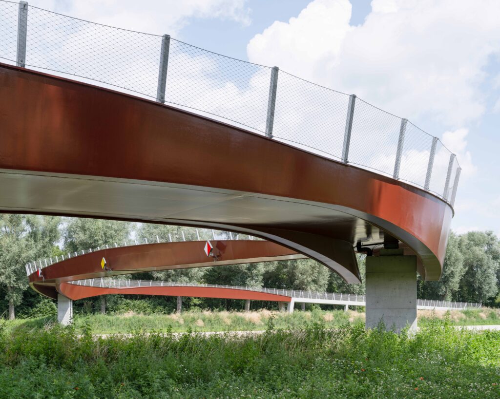
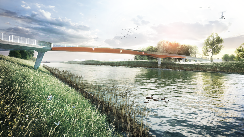
An extensive nautical study was carried out to reach 140 because the successive bends must not be too sharp for the passage of larger ships in the future. In addition, efforts are being made to create as much space as possible for the natural layout of the banks. The bridges and quay walls will be retained and are therefore a hard precondition for the nautical study. The new fairway axis serves as the basis for the development of the banks.

The purpose of the green banks is to create additional typical riverine habitat, resting or foraging areas for a variety of species. The interventions in favor of fish are worth mentioning, where the new banks offer spawning, resting, and foraging places. These are distributed along the entire length of the Lys and consist of a wide range of wetland areas and areas separated by the foreshores, resulting in different water depths, flow velocities, and vegetation. To prevent the foreshores from forming a barrier to both terrestrial and aquatic animals, reptiles, and amphibians, some fauna exit points have been designed. But land animals will also benefit from the new banks, due to the close link with the Lys. The new banks will significantly increase the recreational value for walkers and cyclists.

SBE focused on the nature-friendly design of the banks, as well as on the technical development. The foreshore was dimensioned for the wave loads that occur as a result of passing ships. The bank itself was fully designed taking into account the loads that may occur and the local preconditions. The balance between the various disciplines was considered in doing so.

Responsibilities SBE


  • The inventory, measurement & completion of knowledge gaps
  • Drawing up a design for the banks, the waterway, and the appurtenances
  • Drawing up a tender-ready dossier
  • Drawing up an application file for the single permit
  • Drawing up the implementation study
  • The follow-up of the execution of the works

Masterplan

  • Seine-Schelde sluis Harelbeke engineering SBE #teamsbe #expertsatplay

    Refurbishment Seine Scheldt

    The Seine Scheldt project is a European initiative linking the Seine Basin (Paris region) with the Scheldt Basin (Antwerp). In Flanders, De Vlaamse Waterweg nv, supported by the European Union, is leading this pilot project. For our country, this means specifically adapting 7 waterways. On the one hand, sailing capacity will be increased, but on the other there is a need to carry out river restoration, recreation on and along the water, and urban renewal.
    View this project

Other subprojects

  • Seine-Schelde sluis Harelbeke engineering SBE #teamsbe #expertsatplay

    Redevelopment of the Leie and lock complex at Harelbeke

    In order to make the Seine-Scheldt section navigable for ships up to 4,500 tonnes, the river Lys in Harelbeke needed to be made deeper. The future-proofing of the water site was accompanied by a new lock and barrage complex, the construction of 3 new bridges (2 fixed and 1 movable), bank defences, quay walls, soil protection and the redevelopment of the immediate surroundings.
    View this project
  • Seine Schelde Leie Doortocht Menen SBE engineering grote schepen binnenvaart waterbouw

    Menen crossing

    The works on the Lys crossing in Menen are on two fronts: on the one hand the straightening of the Lys itself in the city centre, which includes new quay walls and a new bridge, and on the other a new bicycle and pedestrian bridge in the outskirts of the project area.
    View this project
  • Seine Schelde Pand 150 Harelbeke Sint-Baafs-Vijve SBE engineering #teamsbe #expertsatplay

    Calibration Lys Reach 150 (Harelbeke to Sint-Baafs-Vijve)

    This subproject involves the passage of the Leie River between Harelbeke and Sint-Baafs-Vijve. The Leie is deepened and widened (calibrated) to allow larger vessels to navigate on the waterway. In addition to the adjustments from a nautical and hydraulic perspective, this project also focuses on the ecological and landscape aspects by establishing nature-friendly riverbanks.
    View this project
  • Vlasbrug Wielsbeke

    Vlas bridge

    Within this sub-project, a new cyclist and pedestrian bridge will be realized over the Leie near the municipality of Wielsbeke and the city of Waregem. After completion, everyone can experience the Leie and tourist attractions on both banks in a pleasant and safe way. The main starting point for the design of the bridge is, in addition to the usual technical requirements, spatial integration within the green characterful landscape.
    View this project
  • Seine-Schelde_Leie Pand 140 Sint-Baafs-Vijve Deinze De Vlaamse Waterweg Seinebekken fietsbrug voetgangersbrug fiets- en voetgangersbrug Zulte SBE engineering #teamsbe #expertsatpla

    Bicycle & pedestrian bridge Zulte

    As part of the subproject Lys Reach 140, De Vlaamse Waterweg is collaborating with the municipality of Zulte to create a new bridge for cyclists and pedestrians. There is also a strong emphasis on both the recreational and functional aspects.
    View this project

Recent projects

From Antwerp to India, SBE is taking steps in progress and innovation all over the world. Below you will find a selection of our most recent projects.

Discover all projects

Our awards

Other news

Curious about what is happening within SBE? Or in which projects we are involved? Through these newsitems we will keep you informed about our projects and the ins and outs within SBE.

Discover our scoops
Seine-Schelde sluis Harelbeke engineering SBE #teamsbe #expertsatplay

Questions?

Do not hesitate to contact us, we are happy to help you!

Contact us